The week of the Balloon Fiesta coincided with the university's Fall Break, a shorter equivalent of the October half term, but at least a step up from Exeter, which gives no such reprieve. With four days off, plus Wednesday night, there was scope to travel further afield than on a normal weekend, and so my friends and I looked west. Initially we had planned to visit Los Angeles, but after much discussion we came to the conclusion that San Francisco was a better Californian city. (Almost the sole reason for travelling to LA was to visit Disneyland, but having already been to the Paris version, I didn't find that attraction especially enticing, and was only encouraged to go to San Francisco instead).
On the Wednesday evening I set off, with the same group that went with me to Utah, into the darkness at the start of a 1,000 mile journey, intending to drive through the night on both the outward and return legs of the trip so as to maximise time spent in California. A mere couple of hours took us along the Interstate to Gallup, which we previously drove through on the way back from Utah, after which it was all new territory. Soon after that, we crossed into Arizona and arrived at the small town of Holbrook. This was a point of interest for me personally, owing to the fact that I spent seven years at the Royal Hospital School in Holbrook, Suffolk, 5,200 miles away. This particular Holbrook was rather different to the quaint East Anglian village I knew so well as it consisted of only a few neon-lit motels and fuel stations.
 |
| In Holbrook, Arizona, complete with RHS clothing |
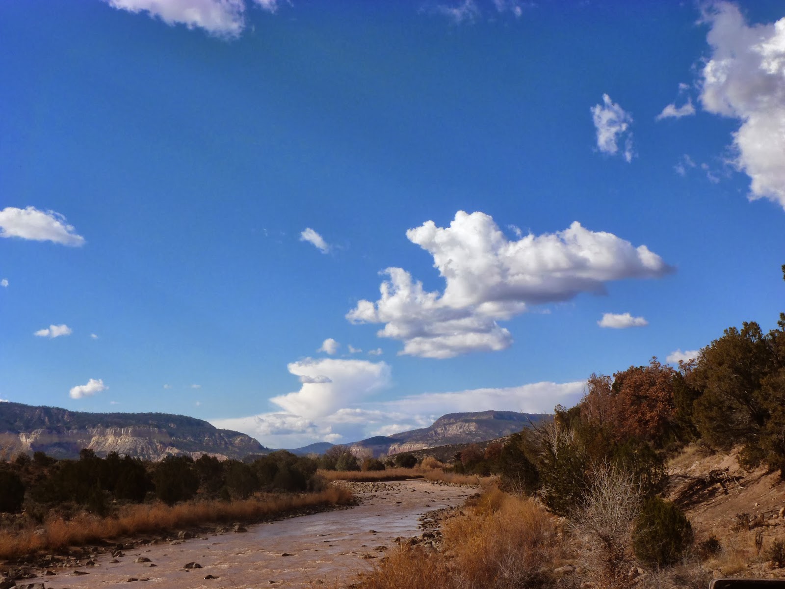
After that, the landscape was so isolated that all the towns we passed through were locations named in the iconic Chuck Berry song 'Route 66'; we had already been through Gallup, and now we came across Flagstaff, Kingman and at around dawn, Barstow in California. There was a definite sense of progress when we crossed the Colorado River and entered the Golden State, even though we were still only around halfway to our eventual destination. The early morning sun over the Mojave Desert was beautiful, and soon after sunrise we came across a similarly impressive sight near California City, the Alta Wind Energy Center. A subsequent search online revealed that this hillside covered in wind turbines is the largest wind farm in the world.
 |
| Sunrise over California State Route 58 in the Mojave Desert |
 |
| The Alta Wind Energy Center |
The remainder of the morning and much of the afternoon was spent moving northwest up the Central Valley. This region of California is one of the most productive agricultural regions of the USA and yet the highway through the middle of it appeared to be the epitome of the term 'dust bowl', with little to show for all the farming that went on there. At length, this arid landscape gave way to more built-up areas as we gradually reached the outer limits of the Bay Area. At my behest, we detoured close to the bay and entered Mount Diablo State Park, with the intention of driving to the summit of the mountain and enjoying the view. On a good day, Mount Diablo is supposed to have the second largest 'viewshed' (total area visible from one point) in the world, after Mount Kilimanjaro. I had optimistically envisaged a magnificent sight all the way to San Francisco and the Golden Gate, along with vistas of much of California in other directions. Unfortunately, the horizon was somewhat hazy and the trip took longer than anticipated, so we gave up on this venture and went on directly to San Francisco via the bridge from Oakland.
 |
| View towards the Pacific from Mount Diablo State Park |
Upon our arrival in the city, we checked into our hostel near the city centre, and then drove north to visit the Golden Gate Bridge. We first saw it from the viewpoint close to Sausalito on the inland side, before watching the last light of the day from the Marin Heights on the Pacific side of the bridge. The evening was then spent back at the hostel and its immediate vicinity.
 |
| San Francisco viewed from Marin County |
 |
| The bridge and the bay, looking south |
 |
| The world's most famous bridge in all its glory |
 |
| And again, under cover of darkness |
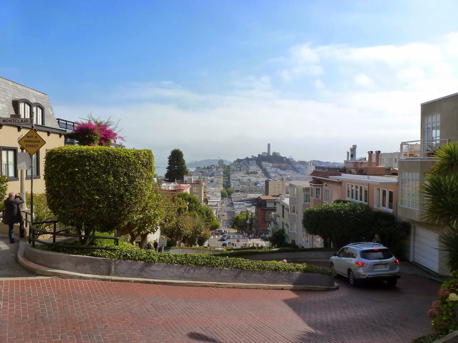
On the morning of the first full day we rose and checked out of the hostel (owing to my insistence that we should not sleep in a hostel all three nights, but should camp at least once so as to save money). The first stop was Lombard Street, one of the main roads in the northern part of San Francisco, made famous because of the small section of it that contains many tight hairpins. At the base of this hill were dozens of Asian tourists snapping photographs; we first drove down the street and then joined the crowd, before climbing up the hill and making our way towards the Fisherman's Wharf area of the city. Here we wandered around some of the shops and took in the atmosphere for a short time before moving on. Two of my friends were determined to go skydiving as part of the trip and so a couple of hours were used up attempting to facilitate their departure to Santa Cruz, and this time was ultimately wasted once they decided that it wouldn't work out after all.
 |
| Lombard Street, suitable for both cars and Segways |
 |
| Looking down Lombard Street from the top of the hairpins |
We stayed in the northeast of the city for the rest of the day, first walking along the waterfront and admiring the San Francisco-Oakland Bay Bridge, and then we climbed the short distance to Coit Tower on Telegraph Hill, from which there were impressive views over the city and the bay. Back at the waterfront, we visited the Alcatraz Departure Pier, from which the boats out to the infamous prison island leave. Owing to the hugely popular government shutdown, Alcatraz was closed, along with all other state-run national parks and monuments. Nevertheless, the pier provided plenty of information about Alcatraz and the island could still be seen from many parts of the city.
 |
| Waterside skyscrapers |
 |
| The San Francisco-Oakland Bay Bridge |
 |
| Pelicans flying over the bay |
 |
| The bay from Telegraph Hill |
 |
| Coit Tower |
 |
| As close as I got to Alcatraz Island |
 |
| Scale model of Alcatraz |
Pier 39 was the next port of call and it proved to be a haven for tourists with a large number of restaurants and shops stocking everything from cowboy gear to magic supplies, and the pier was also home to a large and rowdy colony of sea lions. This part of the city contained a huge number of tourists but there were also several street musicians and one or two shady characters who seemed to make a living by conning the tourists. One faux-pier warden attempted to give me a fine for exposing my legs in public on account of my wearing shorts!
 |
| Pier 39 |
 |
| Pier 39 with Coit Tower in the background |
 |
| Pier 39 sea lion colony |
 |
| Sea lion fight |
 |
| One totally chilled-out sea lion |
 |
| Alcatraz Island |
 |
| The Golden Gate Bridge from Pier 39 |
After finishing up on Pier 39, we migrated into Chinatown for the evening and I found it hard to believe just how much cheaper things were in the shops here compared to the tourist areas elsewhere in the city. I had been unsure exactly what to expect as the only Chinatown I had previously been to was the one in Washington DC and the San Francisco version certainly contained a bit of everything! Indeed, until recently, this Chinatown was the largest in North America; it has now been displaced by Vancouver. After a Chinese meal for supper and a stop at the Chinatown Gate, we drove through the city towards the Marin Heights to stay the night close to the Golden Gate Bridge. En route we diverted along Castro Street, the heart of San Francisco's gay nightlife and home to numerous male-oriented bars and clubs. I was surprised at just how open this place was because even in the space of a few minutes' drive through this area, there were two occasions when our vehicle was approached by men interested in showing us a good time; I would have thought that there was enough of a gay scene to satisfy any man's needs without having to attract passing trade as well! The day ended in a car park on the north side of the Golden Gate Bridge with similar camping arrangements to that of Utah.
 |
| Chinatown |
 |
| San Francisco by night |
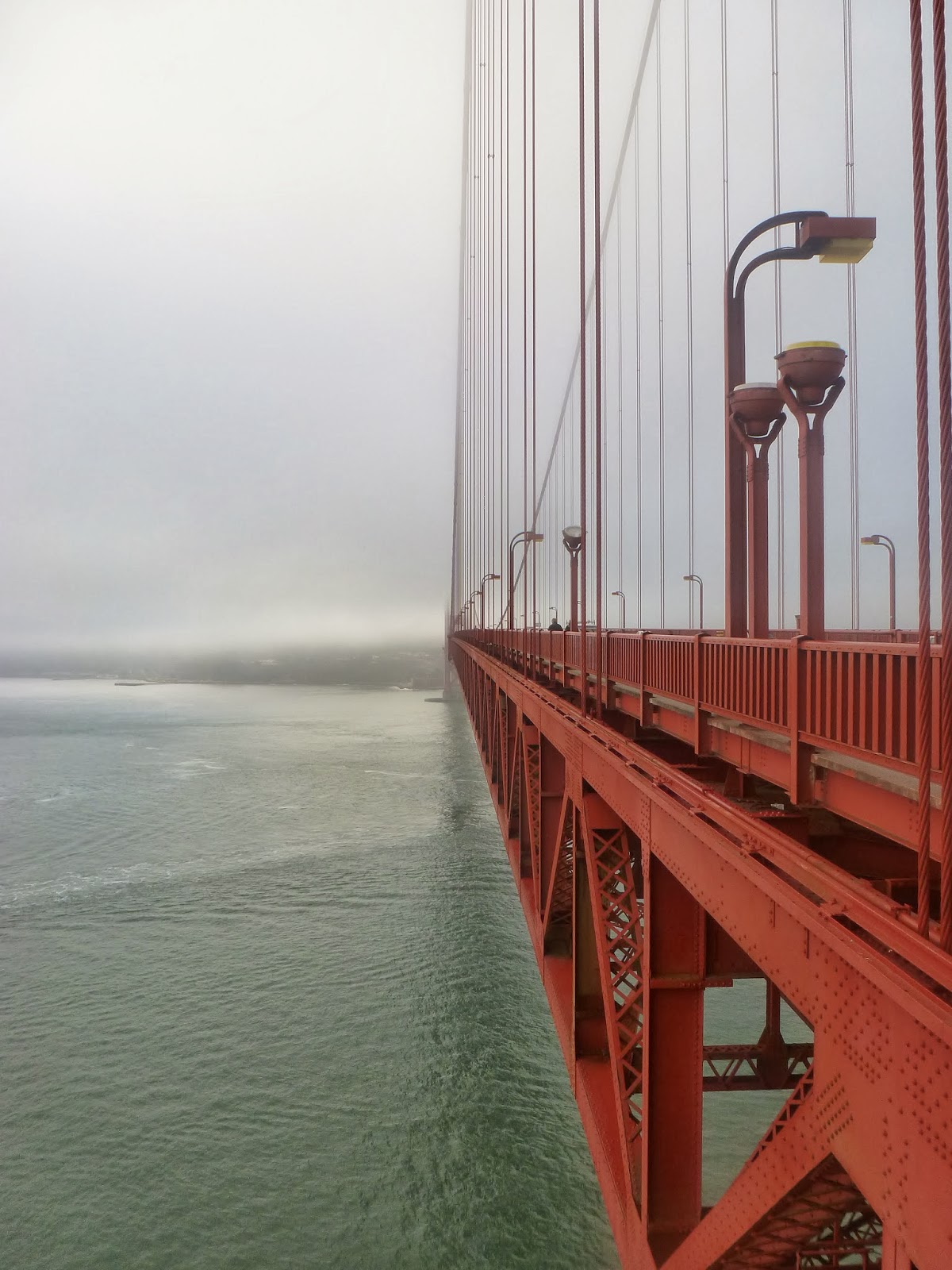
Saturday dawned and we were up early to walk the short distance up to the headland to view the bridge for a second time. As is often the case, there was mist over the Golden Gate but it still presented a stunning photography opportunity. Before moving on, we also took the time to walk across the bridge. Even at the level of the road deck, the drop to the sea was scary, so I was glad not to find myself close to the top of the supporting towers like Roger Moore in the Bond film
A View to a Kill! Back in the city itself, we first passed the Painted Ladies, a set of brightly coloured houses, and then spent time in the Haight-Ashbury district of the city. Personally, this was a hellhole full of hippie- and fake-hippie shops along with overpriced 'retro' goods and a drug-dependent clientele. One man, who appeared to be homeless, was standing on a street corner holding a placard asking for donations of weed, rather than money! It was with a due sense of relief, then, that I was able to make an alternate plan and leave my friends, who would spend more time on Haight Street.
 |
| The Golden Gate Bridge shrouded in mist |
 |
| Suspension cables disappear into the cloud |
 |
| Even from here, it was a long way down! |
 |
| Abstract shot of a suspension tower |
Last year I spent two weeks in Spain at a Pueblo Inglés camp designed to improve the English of Spanish teenagers, and whilst there I met many fellow native English-speakers from the UK, Ireland and further afield. Two girls who were also at the camp are from Oakland, so after telling of my travel to their part of the world they made a plan to come across the bay and spend the afternoon on the San Francisco side. Thus, I was able to make a getaway from Haight in order to rendezvous at Ocean Beach, where our group had aimed to finish off the day. So as not to miss out on the afternoon's activities, I walked through Golden Gate Park to reach Ocean Beach and was therefore able to take in the main sights of the park; the others went on to spend their afternoon in the park. I saw the Japanese Tea Garden, several small lakes and wooded parts of the park before stopping to admire the bison that are kept there.
 |
| Golden Gate Park |
 |
| Japanese Tea Garden |
 |
| American Bison (commonly but erroneously known as 'buffalo') |
As I emerged onto the coastal highway, I had an eye-opening encounter with a homeless man, who went into a tirade full of swear words directed at me for avoiding him. Alarmingly, I had only known to walk away from him because he had eagerly started practising his punching motion whilst I was fifteen or twenty metres shy of him, so he clearly had malicious intent. It was decidedly strange to come across such a character only a short way out of the Golden Gate Park, a quiet, family-oriented part of the city, and very worrying to consider what might have resulted had the man been a little more confident in his ability to assault me without needing to rehearse his punching mechanism.
Shortly after that unpleasant little incident I met up with my friends and they decided that it was too cold for the beach and instead took me by bus back to the city centre. For mid-October, the weather seemed more than agreeable for sitting on a beach but I suppose as Californians, their expectations were slightly higher! After aborting that plan, we went to a taquería (despite my assurances that Mexican food is readily available in the Southwest!) and then a coffee shop, spending an enjoyable few hours reminiscing about the summer spent in Spain and swapping some hilarious stories. An added bonus was getting a little of an insider's take on San Francisco and taking a short trip on the BART (Bay Area Rapid Transport), which was a marked improvement on the Washington DC metro but still a way off the London Underground in terms of ease of use.
Once it got dark, the two girls headed for the nearest station to return to Oakland and I arranged to meet up with the others and decide on a plan for the final half-day and the journey back to Albuquerque. Having had no luck finding proper accommodation for the night, we resigned ourselves to a second night sleeping rough, and therefore elected to leave San Francisco and make some headway south to shorten the journey a little bit for the following day. We began driving down the Pacific Coast Highway, widely regarded as one of the ultimate driving roads in the world, although the most scenic sections are in southern Oregon and near Big Sur, a little too far south to be practically included in our itinerary. We had a late supper at an In-N-Out Burger joint, a recommendation from my Californian friends owing to its positive reputation and the fact that it is only to be found in the west of the country. The night's stop was just beyond Santa Cruz in a tucked-away rural area beside a pumpkin field!
On the final morning, there was still time for one last dose of excitement and this took us a little further south of Santa Cruz to Monterey. This was definitely worthwhile following the decision not to swim at Ocean Beach. A few locals seemed to think we were nothing less than insane to brave the ocean in October, but the conditions were hardly worse than an English beach in July and besides, I couldn't really visit a new ocean without dipping my toes in. Having left my swimming kit in New Mexico, peer pressure forced me in in my underwear so I absolutely embodied the unstylish Brit abroad! After a stay that was cut short by the reality that we still had over 1,000 miles to get back to UNM, we reluctantly left the ocean behind us and returned inland.
 |
| Monterey Beach and the city beyond |
 |
| The golden sun and sands of California |
 |
| Long-billed curlew |
 |
California Brown Pelican
I saw these diving gannet-like into the water to catch fish |
 |
| Emerging, entirely unconscious of fashion, from the sea |
Like many teens in the English-speaking world, I studied John Steinbeck's seminal work
Of Mice and Men at GCSE level and so I was oddly excited to pass through Salinas and Soledad, where the book's events take place, on the way from Monterey back to the Interstate. Seeing it firsthand, the Salinas Valley was not how I'd imagined it, but it was definitely interesting and the bleakness of the landscape was undoubtedly reflective of the bleakness of the book.
The rest of the journey passed with almost nothing of interest as everything had already been seen on the outward journey. The wind turbines near California City were again an intriguing landmark, but after that I spent much of the drive asleep until we rolled into UNM at 0500 on Monday morning to bring a long, tiring, yet totally worthwhile trip to an end.
 |
| The Salinas Valley near Soledad |
 |
| Passing back through the Alta Wind Energy Center |
 |
| In an echo of the start of the trip, the sun sets over the Mojave Desert |